
Why Mapping Underground Irrigation Lines is Non-Negotiable
Mapping underground irrigation lines ensures system integrity during landscaping or sod install by preventing line strikes and hydraulic failure. It allows for precise yard cleanup without damaging solenoid valves or lateral lines, saving thousands in hardscape repairs and emergency plumbing costs. Don’t dig blind. Water is heavy, and mistakes are expensive.
I always drill into my new crew members: if you don’t fix the soil grading first, every plant you put in the ground is just expensive compost. Last season, I had an apprentice take a trenching shovel to a bed we were prepping for a high-end native planting. He didn’t check the irrigation map because he thought he ‘knew’ where the lines were. Five minutes later, we had a six-foot geyser and a flooded crawlspace. That mistake cost the kid his weekend and me a $1,200 emergency repair bill. We don’t guess in this business. We verify. If you are planning a sod install or a major yard cleanup, you need to treat your subsurface infrastructure like a minefield. One wrong move with a power rake or an aerator and you are looking at a hydrostatic pressure nightmare that can undermine your hardscaping foundations.
The Physics of Subsurface Mapping and Hydraulic Flow
Locating irrigation components requires an understanding of hydraulic gradients and soil density, as PVC piping and polyethylene tubing behave differently under compaction. Proper mapping involves identifying the main line, lateral lines, and valve manifolds to ensure pressure regulation remains consistent across all hydrozones. Without this data, landscaping projects risk soil erosion from undetected leaks. You have to understand that water in a pressurized system is seeking a way out. If you nick a line, even a pinhole leak can wash out the modified gravel base of a patio in weeks.
“Irrigation systems should be designed and mapped to ensure that water application rates do not exceed the soil infiltration rate, preventing runoff and structural instability.” – Texas A&M AgriLife Extension
When we map, we aren’t just looking for pipes; we are looking for the story of the yard. We look at the static pressure at the meter and the dynamic pressure at the furthest head. If you see a drop in PSI that doesn’t align with your friction loss calculations, you’ve got a problem. Mapping helps you find the ghost in the machine. We use electronic valve locators that send a low-frequency signal through the tracer wire. If your previous contractor didn’t install tracer wire, you’re back to manual probing or ground-penetrating radar. It’s tedious. It’s hard work. But it is necessary.
How do I find my irrigation valves underground?
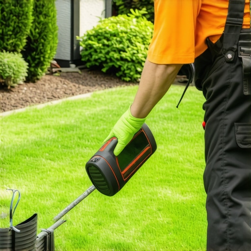
Finding buried valve boxes requires a solenoid chatter trigger or an inductive signal transmitter to trace the electrical pulse from the irrigation controller. Once the signal path is established, use a soil probe to gently find the edges of the box. Do not use a spade. You will crack the lid. Listen for the click. If the valve is failing, it won’t chatter. Then you are looking for moisture plumes in the soil profile. This is where horticultural expertise meets civil engineering. You have to read the turf. Darker green, faster-growing grass often indicates a slow-leaking valve or a compromised manifold.
Mapping Methodologies and Tool Accuracy
Choosing the right mapping technology depends on the soil type, with heavy clay requiring electromagnetic induction while sandy loam allows for more effective manual probing. Professional irrigation contractors utilize GPS-tagged blueprints to create a permanent record of the subsurface layout. This data is critical for future landscaping expansions or drainage modifications. Digging without a map is a recipe for structural failure. We often see retaining walls leaning because someone hit a drainage pipe or a main line and didn’t tell anybody. The water builds up, the hydrostatic pressure increases, and the wall fails.
| Method | Accuracy | Required Tools | Best Soil Conditions |
|---|---|---|---|
| Electronic Tracing | High | Wire Tracker/Transmitter | Any (Requires Tracer Wire) |
| Manual Probing | Medium | Steel T-Probe | Moist, Soft Soils |
| Acoustic Detection | Medium | Ground Microphone | Hard Surfaces/Compressed Soil |
| Ground Radar (GPR) | Very High | GPR Cart | Non-Conductive Dry Soils |
“A retaining wall doesn’t fail because of the stone; it fails because of the water trapped behind it, often from unmapped irrigation leaks.” – Hardscape Engineering Axiom
During a yard cleanup, it is easy to forget about the sprinkler heads hidden under overgrown turf. Before you bring in a skid steer or a power rake, you must flag every irrigation head. We call this the ‘Red Flag Protocol.’ If we don’t see a flag, we don’t drive there. It’s that simple. In arboriculture, mapping is even more vital. If you are planting native trees, you cannot have a lateral line running right through the future root ball area. Root girdling will occur as the tree grows, eventually crushing the pipe. Or the pipe will leak, and the excess moisture will cause root rot (Phytophthora). Neither is a good outcome.
Can you find PVC pipes with a metal detector?
Standard metal detectors cannot locate PVC irrigation pipes because polyvinyl chloride is non-metallic and does not disrupt electromagnetic fields. To find PVC lines, you must use a tracer wire, a GPR system, or acoustic frequency methods that detect the vibration of water flow. This is a common DIY mistake. Homeowners buy a cheap metal detector and think they are safe to dig. They aren’t. Unless you have copper lines (rare in modern residential systems), that detector is a paperweight. You need a professional locator who understands frequency modulation.
The Professional Mapping Checklist
Executing a precise irrigation map involves a systematic audit of the controller zones, valve locations, and emitter spacing. This mapping protocol ensures that sod install projects achieve 100% head-to-head coverage without leaving dry spots or causing waterlogged soil. Follow these steps before you start any landscaping work:
- Zone Identification: Turn on each zone and flag every active sprinkler head with color-coded flags.
- Main Line Tracing: Locate the backflow preventer and trace the main line to the valve manifolds.
- Depth Verification: Use a soil probe to determine the burial depth (typically 8-12 inches for laterals).
- Electronic Marking: If tracer wire is present, use a transmitter to map the exact path of the pipes.
- Digital Record: Take photos of the flagged yard from a high vantage point and overlay them on a site plan.
Once you have your map, don’t just file it away. Laminate it and tape it to the door of your irrigation controller. When the next landscaping crew comes in to do a yard cleanup or sod install, they won’t have to guess. They will know exactly where the lateral lines are. This is how you manage a high-end property. You don’t leave things to chance. You control the variables. If you’re dealing with heavy clay soil, remember that compaction can shift pipes over time. Re-verify your map every few years. Gravity and soil heave are constant forces. They don’t take days off. If you ignore the underground reality of your yard, the yard will eventually remind you of it in the most expensive way possible. Stick to the measurements. Trust the PSI. Map the lines.